


New satellite will improve earth monitoring capabilities of the U.S. government.
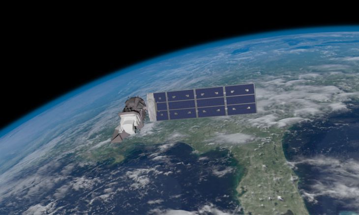
The Department of the Interior announced last week that it had begun to receive images from Landsat 9, a satellite project launched by the U.S. Geological Survey (USGS) and the National Aeronautics and Space Administration (NASA). The new images from this satellite focused on Detroit, Michigan, and Lake St. Clair to monitor the quality of the water. Landsat 9 has the ability to take 1,500 images of the earth every day.
Interior Secretary Deb Haaland stated, “The imagery provided by Landsat 9 will be integral to visualizing the globe’s changing landscapes and empowering landowners, Tribes, and local and state authorities in their own planning and decision-making. We are so proud of USGS, NASA, and everyone who contributed to the successful launch of this groundbreaking technology, which will better support efforts of environmental sustainability, climate change resiliency, and economic growth around the world.”
As the Lord Leads, Pray with Us…
- For NASA as researchers continue to create top-of-the-line scientific equipment.
- For officials of the U.S. Geological Survey to better understand how the planet changes over time.
- For Interior Secretary Haaland to seek God’s direction on how best to use the data from Landsat 9 to conserve American lands.
Sources: Department of the Interior, NASA