


Federal weather agencies state that continued extreme cold watches and advisories remain in effect.
UPDATE Jan 26th 12:20 AM EST
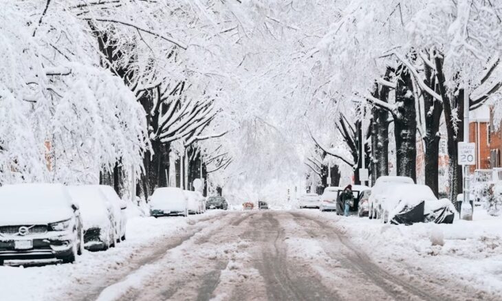
The National Weather Service (NWS) Weather Prediction Center reported that winter storm warnings remain in effect for New England. Up to 18 inches of snow is forecast for the region.
The service stated, “National Weather Service radar indicates that snow continues to fall over upstate New York, New Hampshire, Vermont, and Maine. While the cold front is beginning to exit offshore the
East Coast, a coastal low pressure offshore New England and a trailing shortwave trough over New England will continue to support snowfall. Some up-slope snow showers are occurring across
the Appalachians as well.”
The NWS cautioned, “Hazardously cold temperatures are entrenched across the eastern two-thirds of the nation. Many of the states recovering from the storm have Cold Weather Advisories and Extreme Cold Warnings active through early week.”
Thousands of flights were canceled over the weekend, and many more delayed, as the winter storm system moved across the country. Roughly 800,000 people were without power as of Monday due to the heavy snow and ice across 34 states. And at least a dozen died due to the frigid temperatures.
UPDATE Jan 23rd 10:00 AM EST
The National Weather Service (NWS) has updated its forecast and warnings for the coming major winter storm. Officials have described the potential for “crippling ice” across a wide swath of the United States.
The agency explained, “High pressure moving southward from Central Canada will bring bitterly cold temperatures over the Plains, the Great Lakes, and the Northeast/Mid-Atlantic. While low pressure lingers over the Gulf Coast, a second area of low pressure moves northeastward along the Southeast and Mid-Atlantic Coast through Sunday.”
The NWS forecast detailed, “The system will produce a significant, long-duration winter storm, with widespread heavy snow, sleet, and freezing rain from the Southern Rockies to New England, lasting from Friday through Monday.”
“The storm will cause significant to locally catastrophic ice accumulations with the potential for long-duration power outages, extensive tree damage, and extremely dangerous or impassable travel conditions,” the service warned. “In the wake of the storm, communities from the Southern Plains to the Northeast will contend with bitterly cold temperatures and dangerously cold wind chills. This will cause prolonged hazardous travel and infrastructure impacts.”
UPDATE Jan 21th, 6:30 AM EST
The National Oceanic and Atmospheric Administration (NOAA) and the National Weather Service (NWS) issued a forecast for the coming weekend showing a large system in the center of the United States beginning Friday and extending through the weekend.
The NWS stated, “A wide-ranging winter storm will produce great swaths of heavy snow, sleet, and treacherous freezing rain from the southern Rockies/Plains and Mid-South starting Friday and shifting toward the East Coast through Sunday.”
“Snow-covered roads and reduced visibilities are the primary hazards to expect,” the agency explained. “Hazardous travel conditions, power outages, and tree damage are likely.”
Earlier this week, Michigan experienced a 100-vehicle pileup on an interstate due to heavy snowfall and ice.
As the Lord Leads, Pray with Us…
- For NOAA Administrator and Under Secretary of Commerce for Oceans and Atmosphere Neil Jacobs.
- For Director Ken Graham as he heads the NOAA’s National Weather Service.
- For Americans recovering from the winter storm to take precautionary measures as the extreme cold continues.
Sources: Weather.gov, US News and World Report, USA Today, Daily Caller, UPI News